

A Sunrise Hike to Carr Fall's Hang Glider Ledge


Waking at 3 am, driving the Jeep up a steep and curvy mountain road, then wandering around in the dark not knowing exactly where the trail might end at the edge of a 1,000 foot cliff.
Yep, that’s how we roll around here. 😎
We’d heard the rumors, and could always see how the cliffs near Carr Waterfall might be a good spot to launch a hang glider. But interestingly, we've never actually seen one in the air; and Kelly has lived here since 2012.
Then Kelly remembered reading a post in one of our local Facebook groups about how some of the earliest enthusiasts of the burgeoning sport during the 70’s and 80’s were here in Sierra Vista, Arizona before moving on to places like Colorado and California. Sadly, we have been unable to locate any contemporaneous news stories or other media about this early hang gliding era. But there are still two active launch sites near the Reef Townsites campground, and apparently with the right qualifications and permits they can still be used: https://www.sahga.com/flying-sites/miller-canyon-guide
Of course we had to see for ourselves …
And since we rarely do things the easy way, we also decided that we should see it right at sunrise. 🙃
The trailhead is only about 13 miles from our house, but since we had to drive up the steep, rocky Carr Canyon road, we figured we should allow about 45 minutes for the drive, then at least another 30 minutes to hike up to the launch sites.
This meant setting the alarm clock for literally O’Dark Thirty.
We found and arrived at the trailhead with no problem, in plenty of time. But then the real “fun” began. In hindsight, we really should have scouted this out in advance during daylight hours. It seemed like the combination of our headlamps and the information we’d gleaned from a YouTube video and our Trails of the Huachucas book would be enough to get us there. But it was a bit of a struggle.
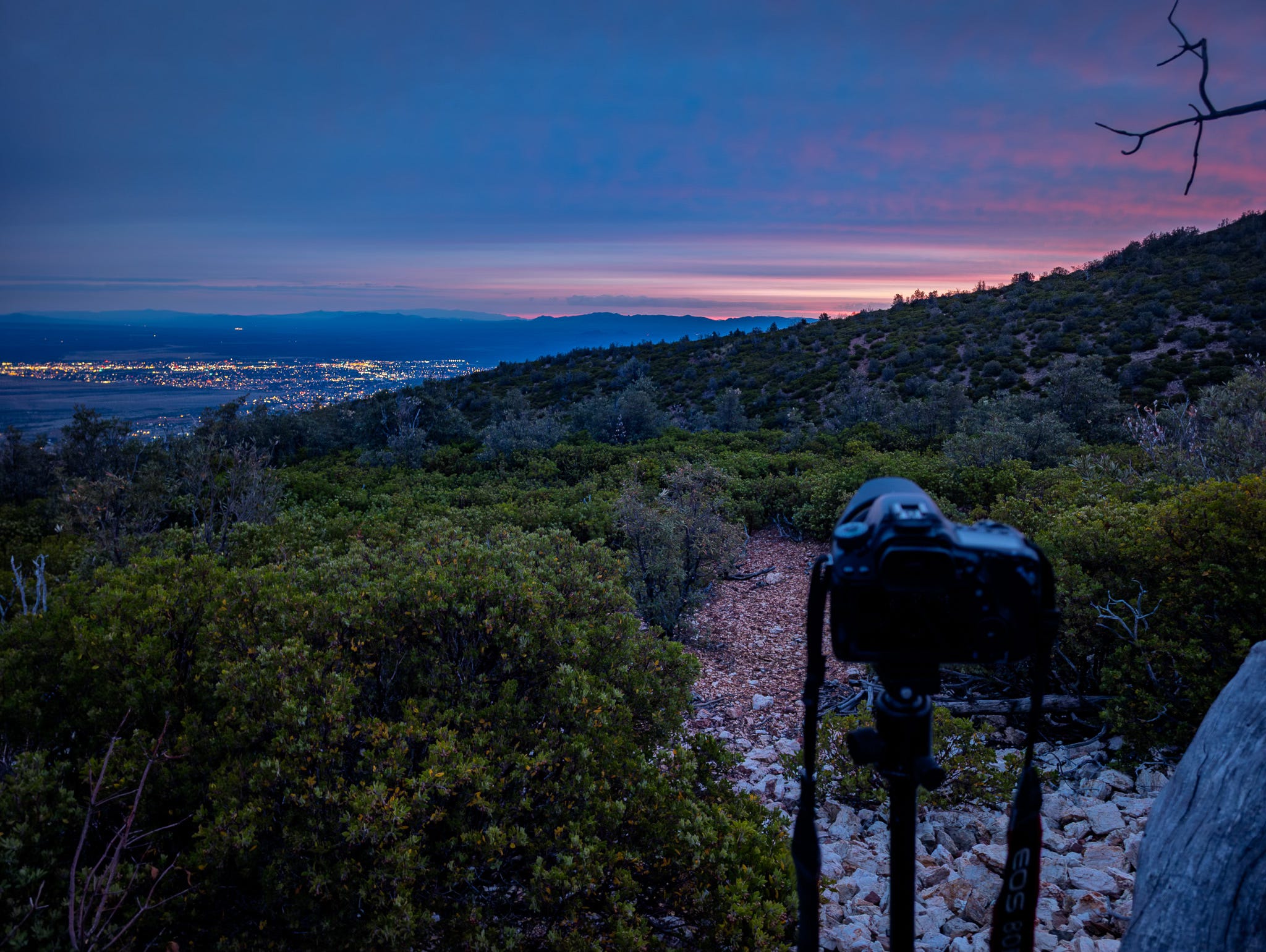
We made a left hand turn about halfway up the trail to what we hoped would be the cliffs. When the brush started getting a little too thick to tell where the trail was, we decided to stop near a cool gray tree. I (Todd) set up my camera tripod, while Kelly climbed up and perched in the tree, waiting to be “wowed” by the colors.


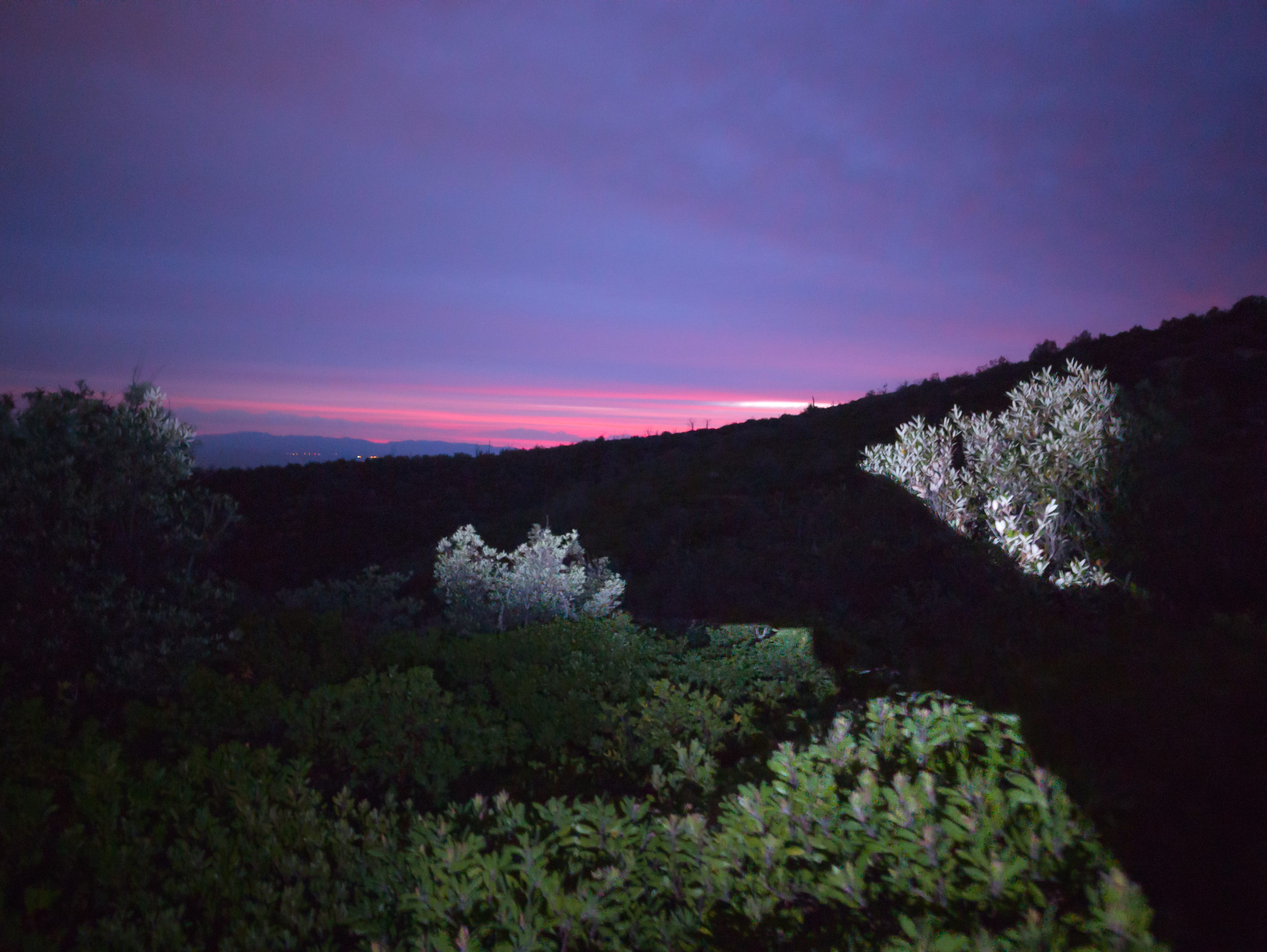
Spoiler alert: although there were some interesting clouds, sadly the pastel colors we were expecting and hoping for never really materialized.
Fortunately, Kelly is not the sitting still type, so at some point before sunrise she took off towards the top of the trail (I stayed put, still hopeful for colors).
And then, Kelly~
I found my way back to the main road, it’s still in passable condition so the hiking was pretty easy going. When I reached the smaller trail split, I was greeted with a phenominal view!
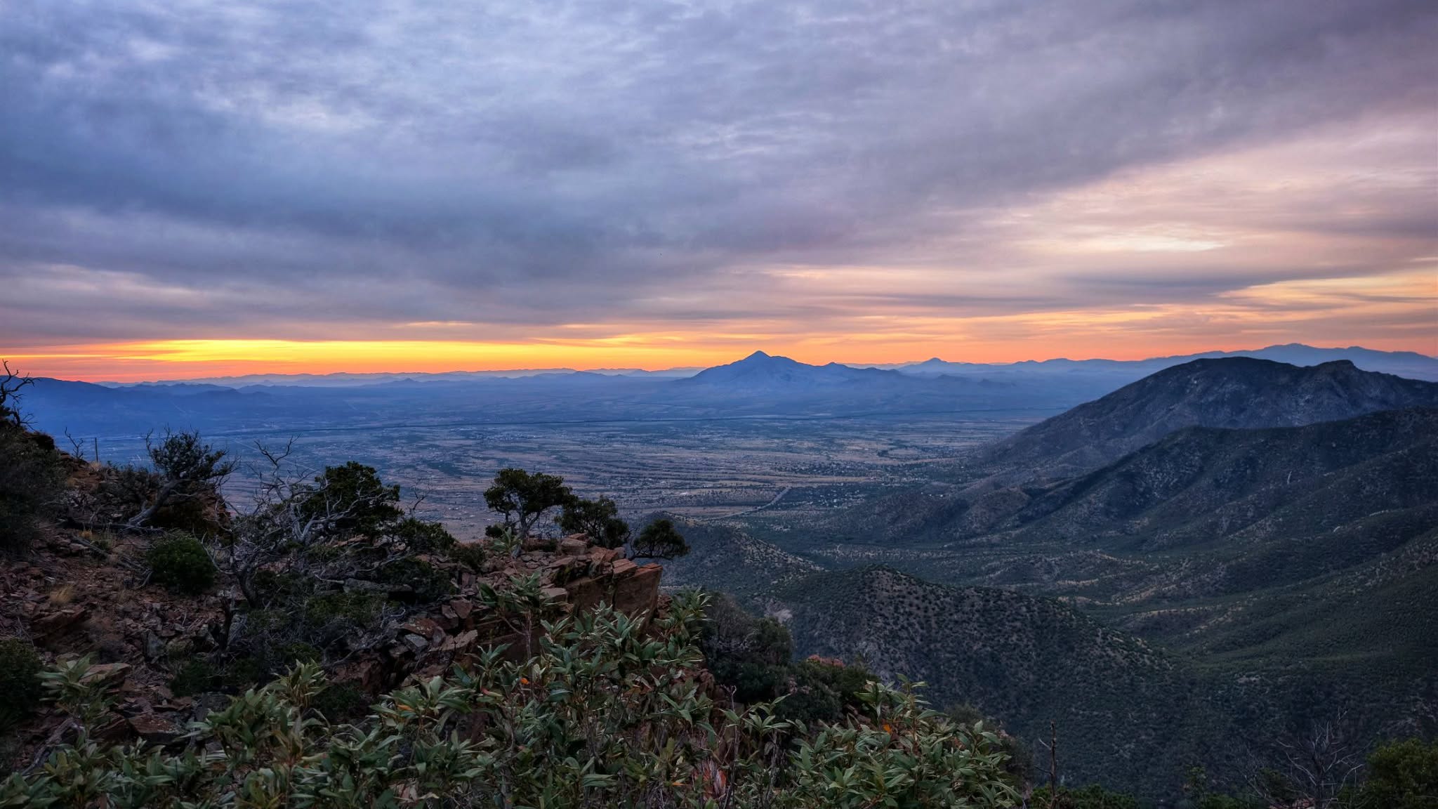
In hindsight, I’m really glad I didn’t stumble onto the actual launch pads while it was still really dark. These launch pads, as one should expect, are literally set at a pretty stark drop on the edge of a cliff. Viewing this, even in nautical twilight, was breathtaking. At the second launch site, I experienced such a fun adrenaline rush, but even I can recognize it would have been much easier to have faulty depth perception and lose my footing. I found a cross at both locations, with a simple phrase, “In Memory of Papa”. More than one person has lost their life. I like to believe that they passed doing the thing that gave them great joy. Is there any better way?


As is my nature, after visiting the first launch pad, I moved toward the other when I spotted a pole reaching upward toward the sky. There wasn’t a trail to get there so I found a bit of a natural wash, where it was easier to bushwhack. It was a short trip to find the “treasure” I’m often rewarded with when I move off the beaten path. I was also greeted with additional breathtaking views. I moved around the back side of the pole and found it was connected to a fairly large solar panel for such a remote area. There was a second small solar panel linked to the west of it. I also found a military box similar to many I’d seen before with journals you can sign. I attempted to open it, but it was padlocked. Uhg, now I may have to remain curious FOREVER~
Why are there solar panels?
What could they be linked to? Is this a “hidden” prepper stash?
Why is the box padlocked?
Should I come back and leave my own sign in journal to see who dares to find what I did?


I was so excited to get up there and see the places where these great adventures happened in the 70’s and 80’s. I’ve heard tales that some of the gliders moved on to further push their limits with squirrel suits. I have definitely confirmed many in the community regularly saw flights in the past and took drives to watch them land in a grassy field just south of a popular restaurant in the nearby town of Hereford. A wind sock still stands in the area, originally intended to assist glider pilots in a smooth landing. I doubt this is the last time I visit. I’m surprised it took so long to begin with. This location provides a great deal of bang for your buck in terms of length of the hike and incredible views.


Do you know anything about the history of the original Carr Falls daredevils, and/or Arizona hang gliding in general? If so, we’d love to hear about it.

Every photo tells a story, and stories are better with company. If you enjoyed this glimpse into our life in the Sky Islands (and beyond), please pass it along to a fellow explorer. Thank you!
In the 70s in Phoenix there was a mountain off of 19th Ave, just south of Thunderbird Rd where people used to hang glide.
I haven’t seen anyone do it in years.
I was hoping you would have been able to see some and share pictures.
Now I’m curious if it’s a thing anymore.