

Flagstaff and Sedona Roadtrip(s)
Possibly the most beautiful part of Arizona

You’ve probably heard me rave about how much I love where I live in southeast Arizona. Seriously, between the Huachuca Mountains and the San Pedro River, there are so many cool locations literally 20 minutes from my front door.
However …
If I could afford to live in Flagstaff Arizona (at least in the summer) I’m pretty sure I’d jump at the chance. Interestingly, I don’t think I’d want to live in Sedona, but I’d certainly love to be close enough for frequent day trips to make more sense.
We’ve been fortunate enough to do some version of the Flagstaff/Sedona double-tap roadtrip three times in the past couple of years.
This post will be a quick synopsis (with a picture or two) of some of our favorite hikes in that part of Arizona. If I write longer posts for any of these spots, I’ll come back and link to them here. Or, you can subscribe to be notified when they hit the street.
Getting There Is Half The Fun
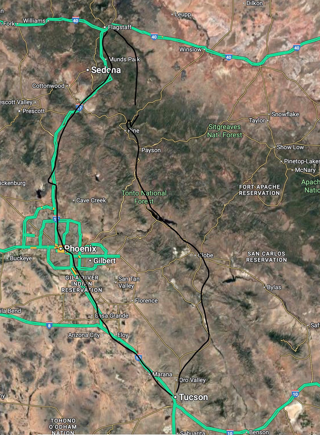
Coming from Tucson, or further south where I live you have basically two choices:
Little winding two-lane roads going past Lake Roosevelt and through some beautiful forests.
Take the Interstate. I-10 through Phoenix, then up I-17
It’s not quite as clear cut of a decision as it may initially seem.
If you choose the scenic route, it’s probably going to take you at least a little (and possibly a lot) longer to get to Flagstaff.
From my house in Sierra Vista, it’s a little over 5 1/2 hours to Flagstaff via the Interstate. It’s closer to 7 hours if you go through Globe, Payson, and Pine (and that’s if you don’t get stuck behind a line of pickups hauling big campers).
That said, I-17 can be its own nightmare … especially on Friday going up, or a Sunday coming down. There are about 5 million people in the Phoenix area, and it seems like a good percentage of them go up to Sedona or Flagstaff on any give weekend.
Choose your own adventure I suppose.
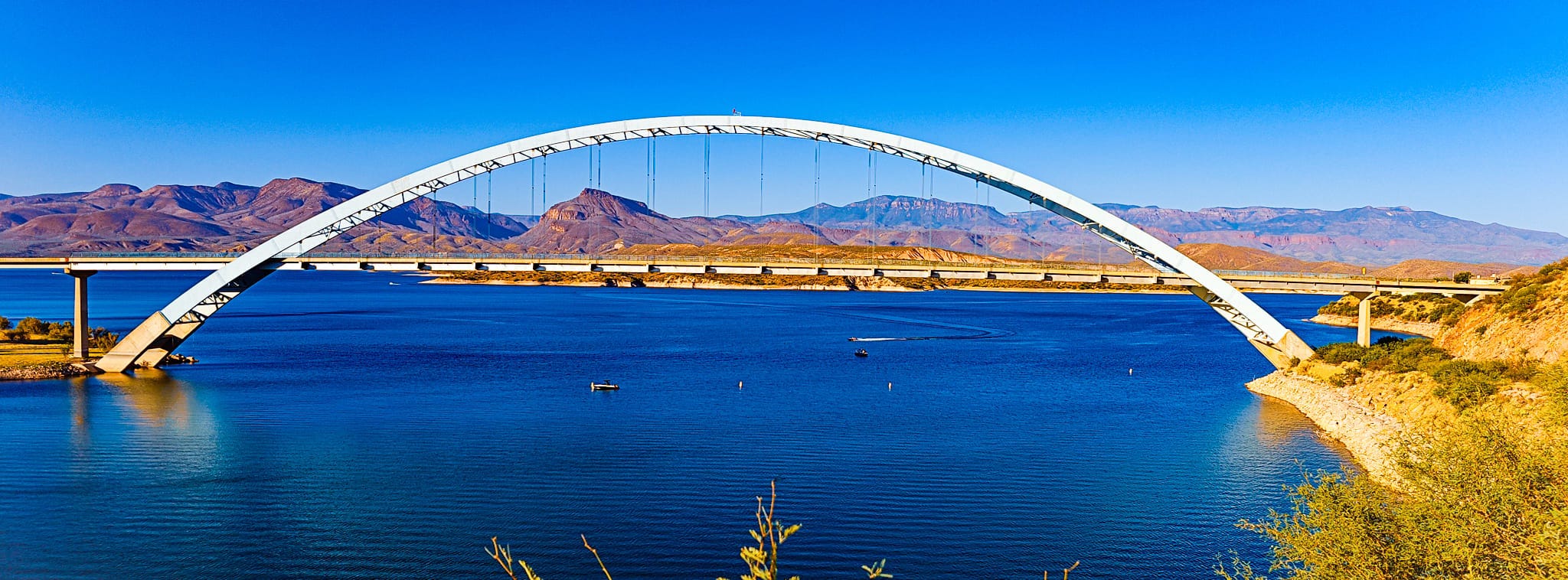
We’ve mostly chosen the Interstate route on our trips. But if you have time, the forest is great on the scenic route, and Lake Roosevelt is worth seeing.
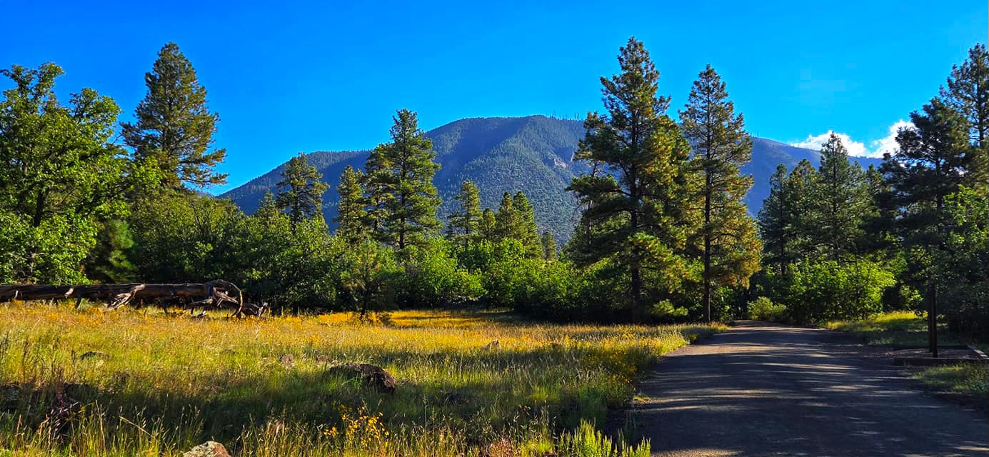
Hikes near Flagstaff
Buffalo Park - This is Flagstaff’s main city park. We were here for a cross country running race. But we came back the next day, and it turns out you can walk for miles in this park, including into the forest where it feels very much not like you’re in a city.
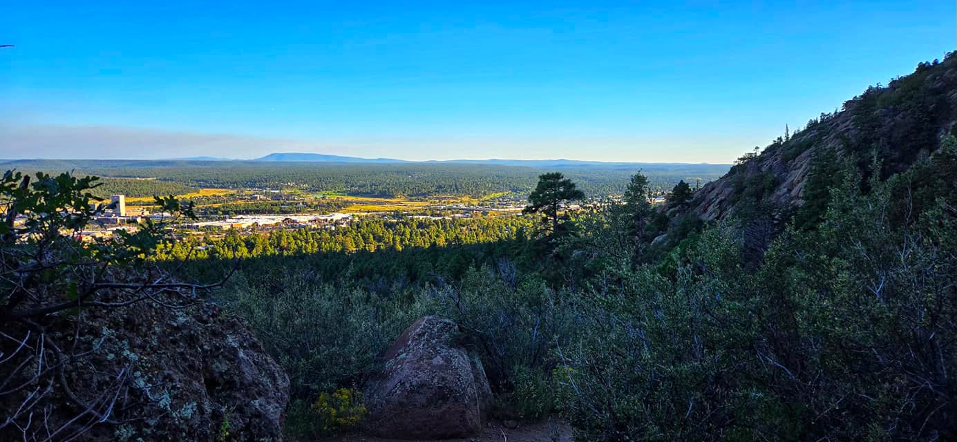
Fatmans Loop - This trail is on the east side of Flagstaff, near Elden Mountain. Kelly did this one on our second trip up there. We’d already done two other hikes in the morning, so I’m pretty sure I took a nap in the car. She said it was a pretty nice hike, and the views were great!
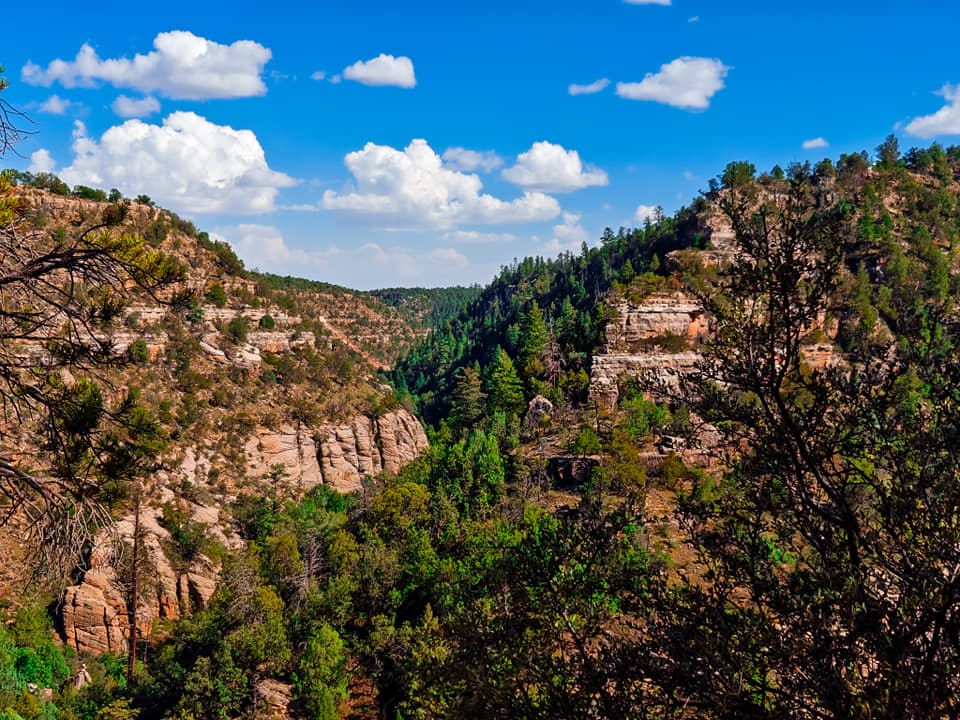
Walnut Canyon - This place is really cool. As we were driving towards it you’re just going through a normal pine forest. I actually wondered why we were going here at all. Then once we arrived it became crystal clear. The views are spectacular, and the history is pretty cool too.
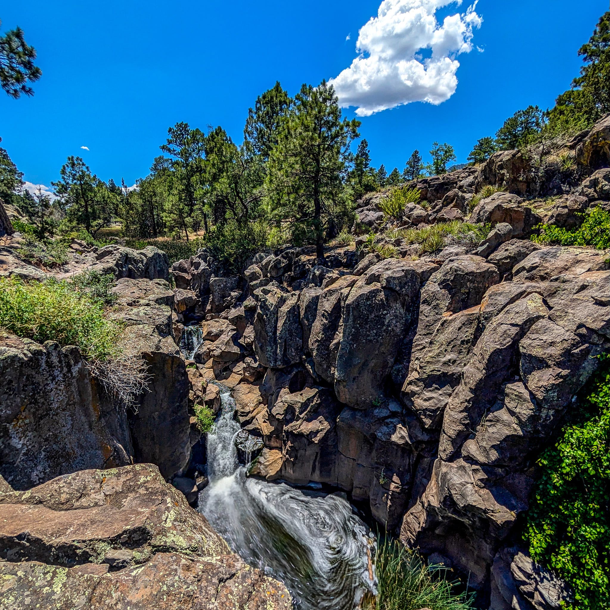
Tom Moody Trail in Picture Canyon - Another Flagstaff city park if you can believe it. This one has a legitimate waterfall. It’s east of the city off of Route 66. Parking was pretty easy, and it wasn’t terribly crowded. I think we ended up walking like a 4 or 5 mile relatively flat loop. Interestingly, the Arizona Trail intersects this park.
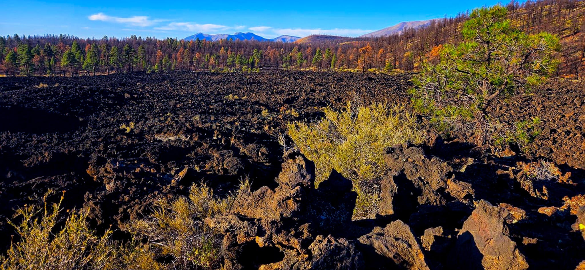
Sunset Crater - This was a neat little detour just northeast of Flagstaff. This is the site of the most recent (about 950 years ago) volcanic eruption in the San Francisco Volcanic Field. There are a couple of nice little viewing areas, and even a little half mile or so trail to walk around. We then continued on to the Wupatki National Monument (which if I’m honest, I don’t think was worth the drive).
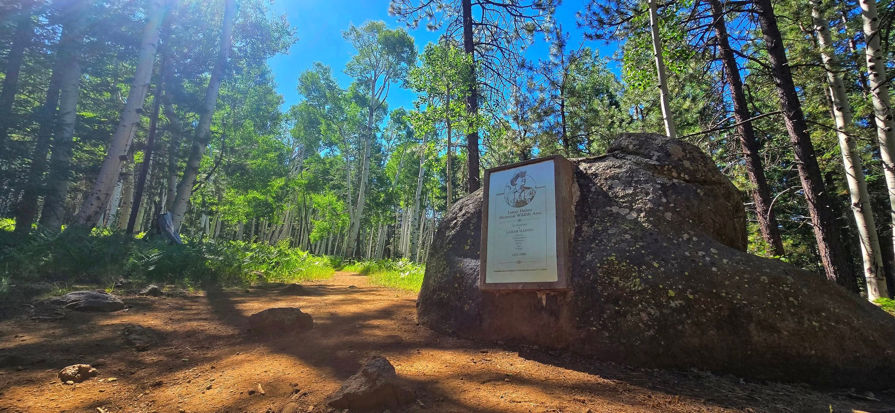
Lamar Haines Wildlife Area - This is a trail that’s about halfway up the snow bowl road. We discovered it the first time when we came to a big hill with powerlines just off of Kachina trail up near the top. Kelly of course wanted to go down the hill. I didn’t not like prospect of having to come back up it later, so went back to the car and planned to pick her up at this trailhead. We went back the next year to actually do the loop trail hike.
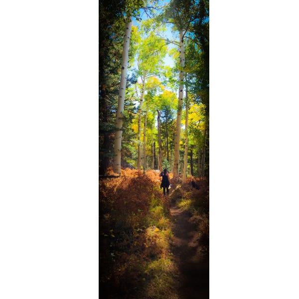
Kachina Trail - We drove up here hoping to see some fall colors. We didn’t quite catch the peak. But man, walking through those tall aspens was still pretty cool. The parking was also an adventure. There was no way were were going to get a space in one of the lots, so we parked along the side of the road, and actually made our own way along some side trails before we reached Kachina.
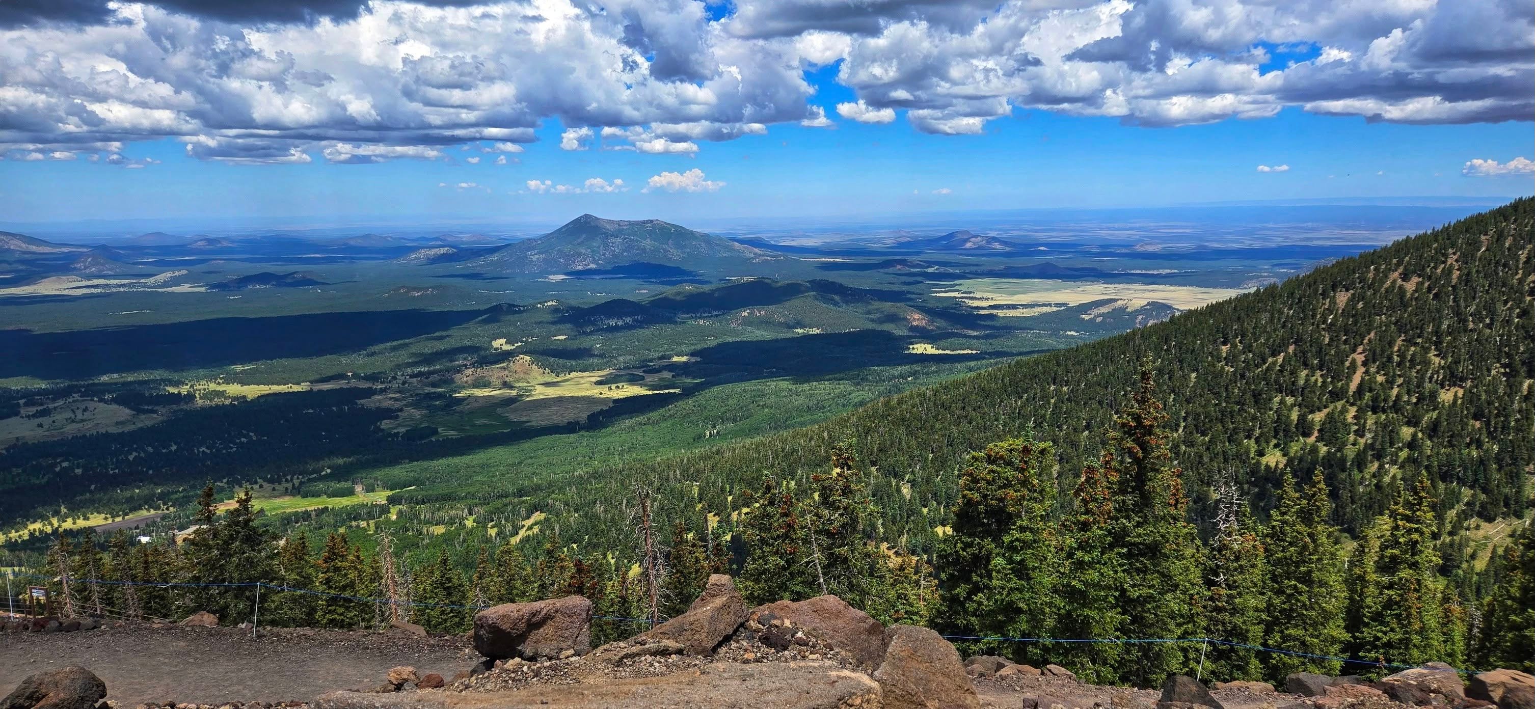
Arizona Snow Bowl (gondola) - I got a coupon for summer deals on the gondola. I’m pretty sure the tickets were only $15 or $20 each. This was great because we were able to get these spectacular expansive views without having to hike all the way up a mountain first 😁. Well worth the money.
Hikes along 89A
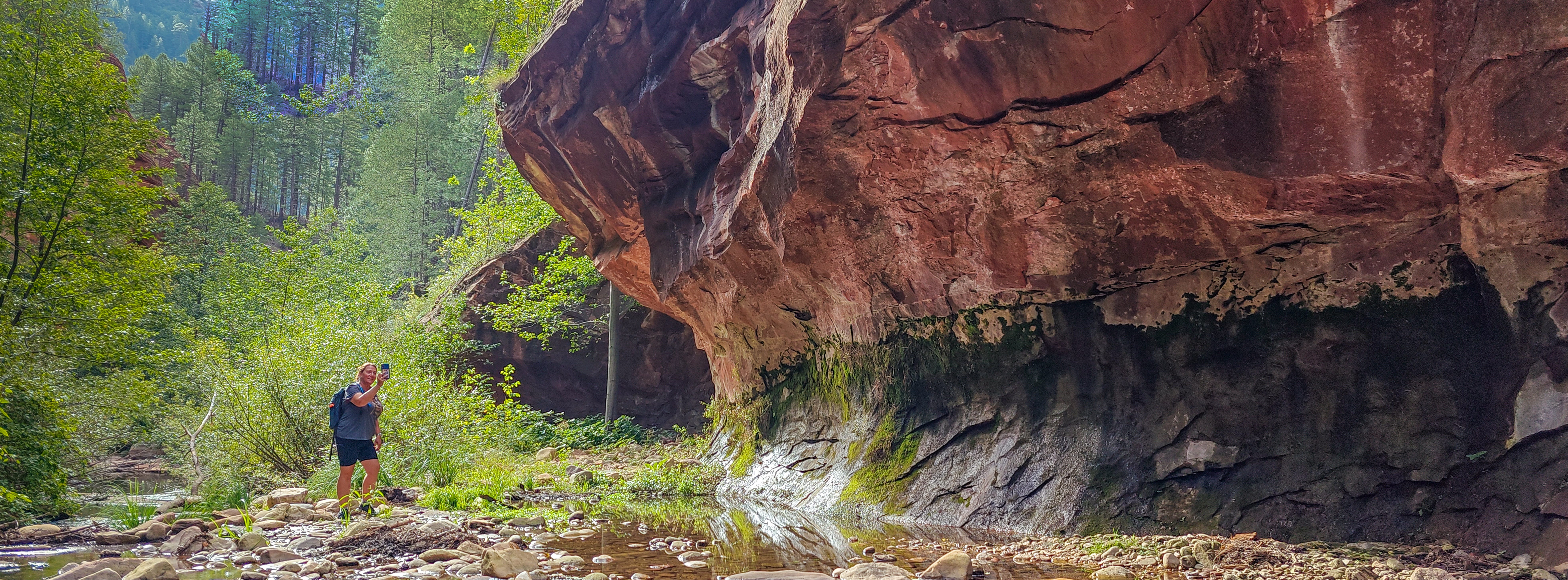
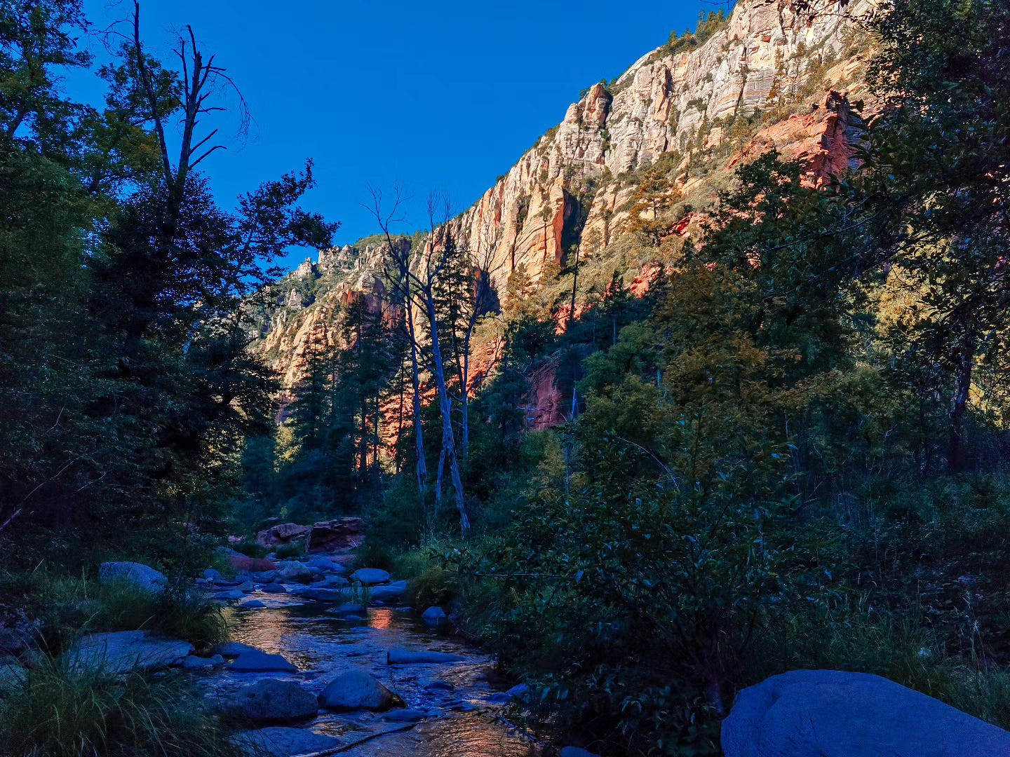
West Fork of Oak Creek - We stopped here almost by accident while driving from Flagstaff to Sedona. I sort of knew this was on Kelly’s list. But stopping wasn't the plan. Somehow we got a parking space (not at all guaranteed), paid the $15 fee, and started off on probably one of the most scenic hikes in all of Arizona not in the Grand Canyon area. The first picture in this post was also from this hike, taken just after we entered the canyon.
Note: there are many other very cool hikes along 89A. But this is the one I’ve been on. We have talked about going to Slide Rock (Kelly and her kids have been). We also tried to stop at Grasshopper Point picnic area the last time we were there. But parking in the summer is nearly impossible unless you arrive very early in the morning.
We will definitely be back up in that area again soon … with more hikes on the agenda.
Hikes in the Sedona area
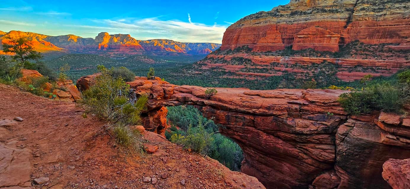
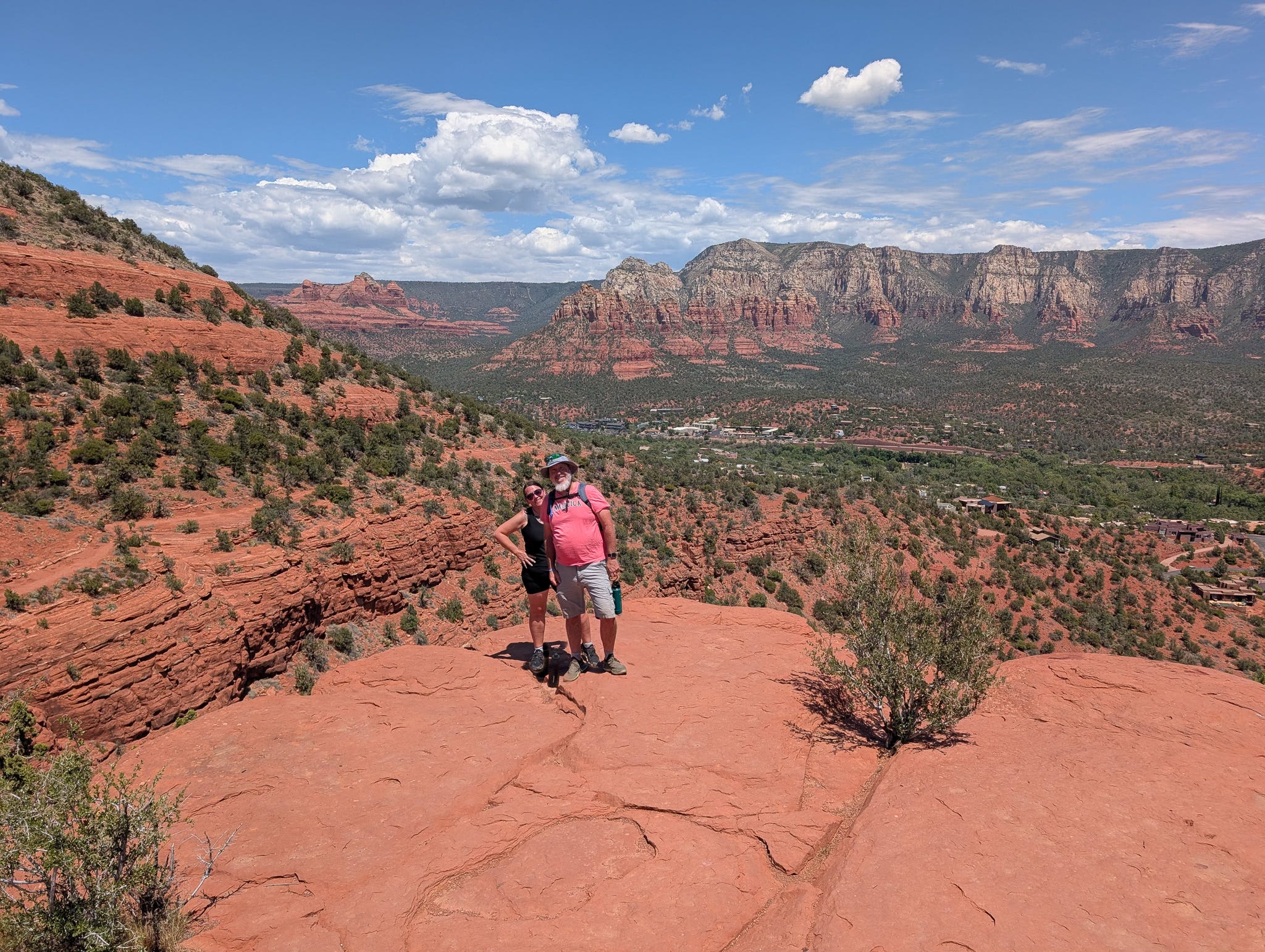
Devil’s Bridge - This one had been on Kelly’s bucket list for a long time. We car camped in Cottonwood and drove up to the trailhead before sunrise to make sure we got a parking space. The hike itself wasn’t too bad. We reached our destination in a little over an hour (now that we have the Jeep, we could have cut off a good chunk of that by not having to walk up Dry Creek Rd). Once we got there, we waited in line with a group of other people. Couples and singles went out on the bridge one at a time, and we even helped take each other’s pictures. It kind of restored our faith in human nature.
Airport Mesa - this was our consolation hike after we couldn’t get parking at any of the swimming spots along 89A. It was about 105 degrees that day, so we didn’t do the whole Airport Loop. But the view from the top of the Mesa rest stop was worth the drive up the hill, then a short hike up the “mountain”.
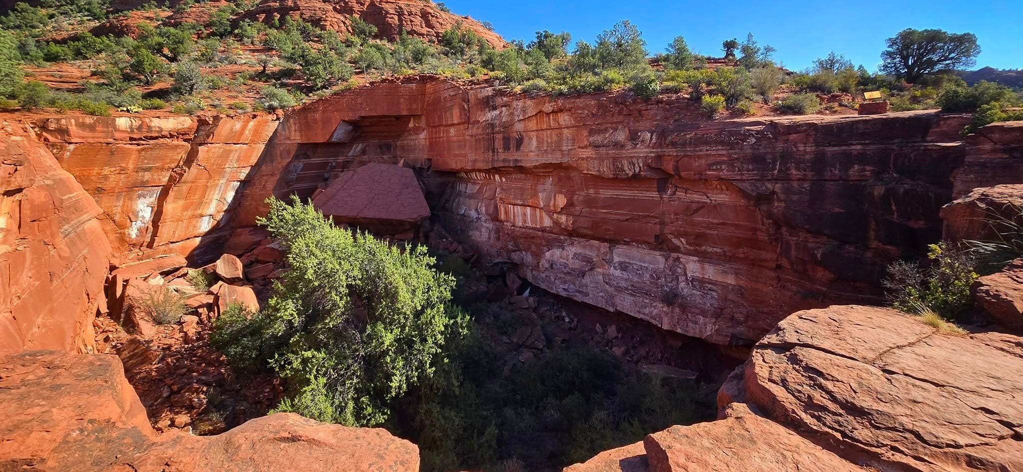
Seven Sacred Pools - This is another hike that Kelly did by herself because we had a problem finding parking (this a recurring theme for this area). I ended up parking about a mile away and just caught up with my picture editing. She said this wasn’t a hard hike, but the geology of how the sinkholes formed was really interesting.
Note: writing this post highlights the fact that when we do these trips we usually stay in Flagstaff and are thus able to get in multiple hikes per day up there. Sedona, like 89A is usually a stop on the way up or the way home. There are so many awesome trails in Sedona, I think I’m going to have to plan a trip where we stay there in town … especially now that we have the Jeep.
There are more pictures from many of these hikes (as well as our other adventures) at: https://www.facebook.com/jotnhill
Your Turn:
Have you been to Flagstaff or Sedona?
If so, what did I miss?
Which spots should we put on the agenda for our next trip?
Til next time,
Todd
p.s. if you’re not a subscriber yet, I’d love to have your join our little group. If you do already subscribe, thank you! Please consider sharing this post with others:

The Four Corners is my favorite place to visit this time of year. Lovely post❤️