

(Futile) Dreams of a White Christmas
Snow is Not happening for southeast Arizona This December.

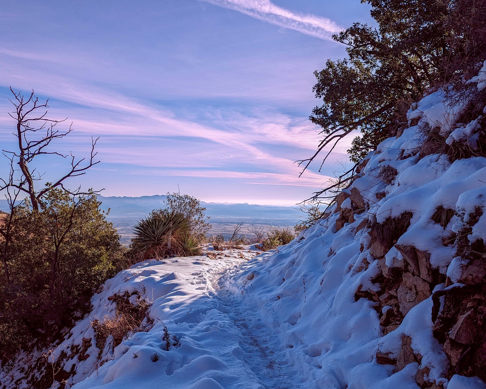
We don’t get a lot of snow in southeast Arizona. Maybe a handful of times each winter. Kelly swears that the first snow of the season usually happens right around Christmas time. Sometimes she’s right, such as in the picture above from my first year back to Sierra Vista in 2022.
Unfortunately, I think Kelly (and others) will be disappointed this year.
Today, December 17th 2025, it’s going to be about 75 degrees in Sierra Vista, Arizona (and warmer than that in Phoenix and Tucson). By Friday afternoon we may hit 80°, and it really doesn’t look like there’s much chance of anything changing until sometime in January.
As of right now, the forecast for Christmas Day is:
Clear skies, light winds, 53° in the morning, 75° by afternoon.
This is great for those of us who might like to go on a Christmas Day hike.
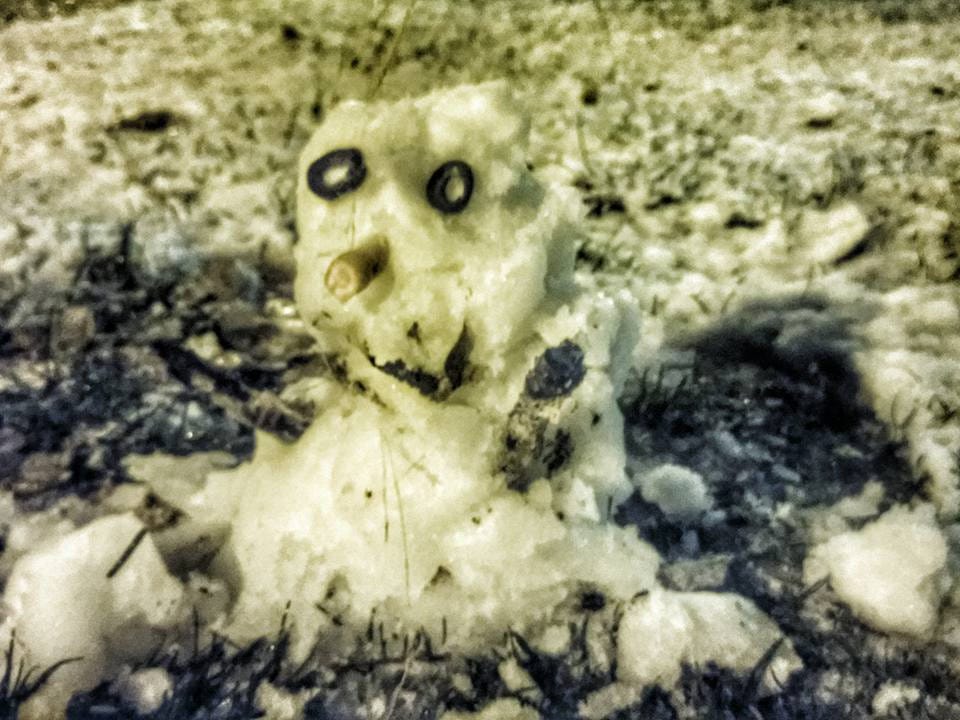
Not so much for those who were hoping to build a snowman.
I guess we shouldn’t be surprised. This is Arizona; we’re not guaranteed snow.
So Why is it So Warm this year?
The short, big picture answer: La Niña
The more specific near term answer: An upper level ridge of high pressure is sitting over the entire southwest United States.
Let’s start with La Niña:
You might wonder how ocean temperatures thousands of miles away can ruin our chances for a snowball fight in Sierra Vista, but everything is connected. La Niña is a climate pattern defined by cooler-than-average water temperatures in the equatorial Pacific Ocean.
When that water cools down, it acts like a detour sign for the Jet Stream; the atmospheric highway that steers storms across the continent. During a La Niña winter, that highway gets pushed further north. Instead of sweeping low across the Southwest and delivering moisture to the Huachucas, the storm track gets shoved up toward the Pacific Northwest and the Northern Rockies.
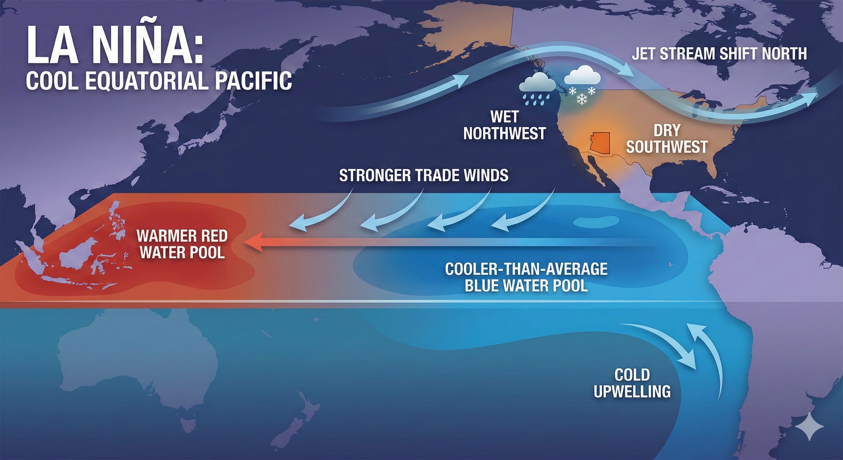
For us, that means the door is effectively closed. While Seattle gets soaked (and boy are they getting soaked right now), we get left with dry air and sunshine.
It doesn’t mean zero precipitation here in Arizona, but it definitely stacks the deck against a White Christmas.
So, La Niña steers the storms away, but that High Pressure Ridge is what’s cranking up the thermostat:
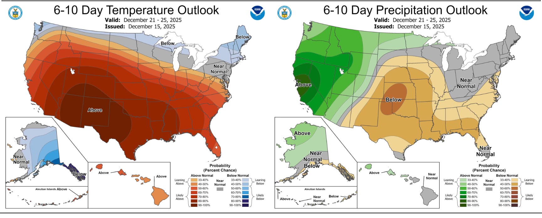
Here’s the 6-10 day outlook from the Climate Prediction Center
And here are the forecast 500mb standard height anomalies for the same timeframe:
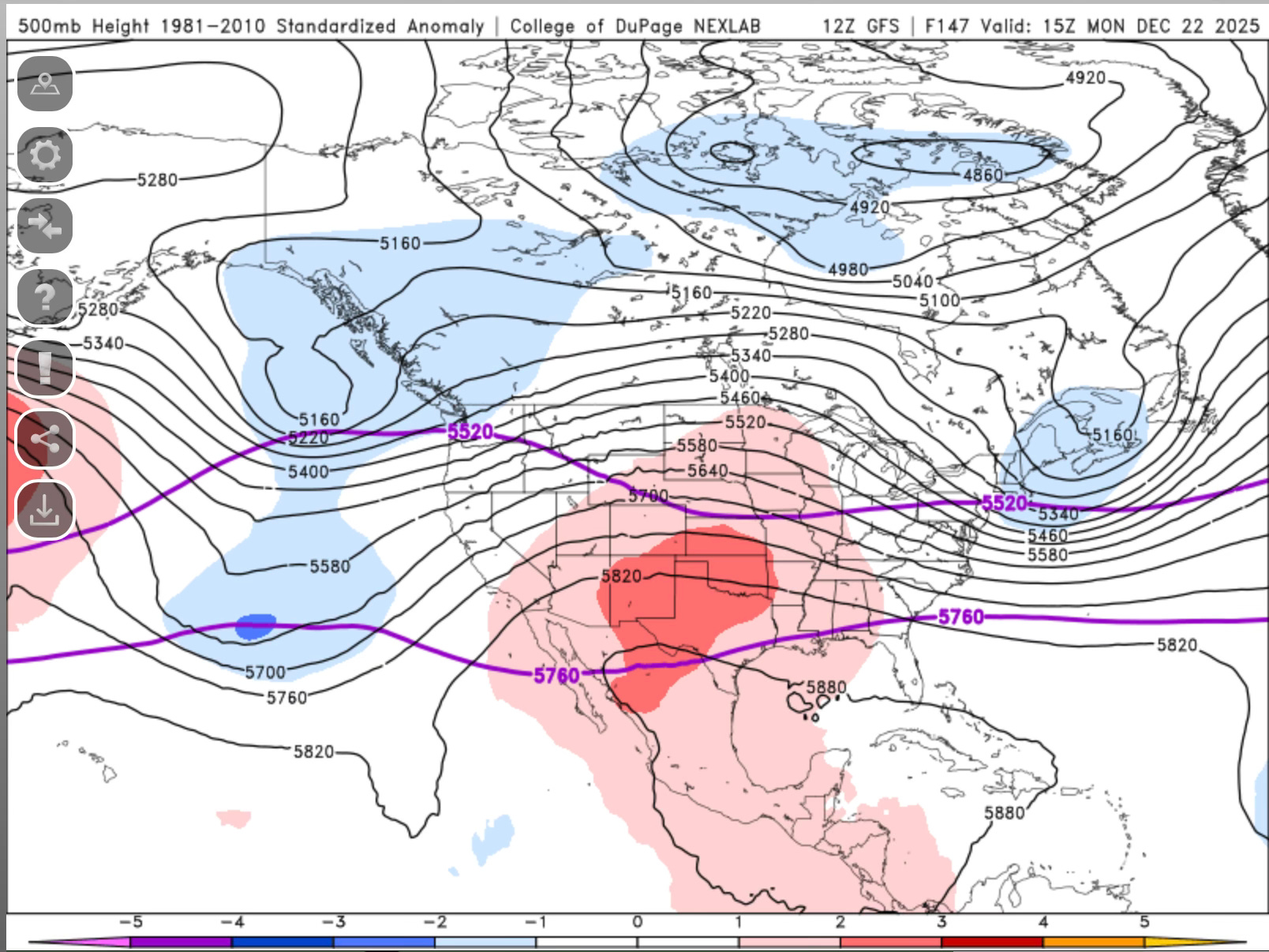
See that big red blob in the middle? Notice how it aligns pretty well with the above normal temperatures and below normal precipitation?
That’s our culprit.
Think of that “red blob” as a massive, towering dome of air parking itself over Arizona, Texas and New Mexico. In the weather world, we call this a Ridge.
High pressure aloft acts like a heavy lid. It forces air to sink toward the ground. As that air sinks, it gets compressed. Think of it like using a manual bicycle pump: when you push that plunger down, the air gets squeezed and the valve gets hot. That is exactly what’s happening to the atmosphere over the southwest United States.
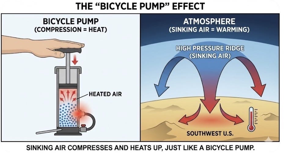
But it’s a double whammy. That same sinking air is a “cloud killer.” Clouds need rising air to form; high pressure pushes everything down. Without clouds to block the sun, the ground bakes all day, and without rising moisture, we have nearly zero chance of rain or snow.
So, while La Niña is steering the storm track away from us, this High Pressure Ridge is sitting on top of us, actively heating the air and squashing any hope of precipitation.
So there you have it. For most of the southwest U.S. Christmas Day may end up being a great day for a hike.
But if you were hoping to break out your gloves and hat to build a snowman, you might be disappointed to find yourself wearing shorts instead.
Til next time,
Todd
p.s. if you’re not a subscriber yet, I’d love to have your join our little group. If you do already subscribe, thank you! Please consider sharing this post with others:
As one who still travels to the grandparents (now great-grandparents), I don't mind the dry roads one bit.
This was a masterclass in meteorology and I think some of the local jucos in your area (I played college ball and courted a few) would love to have you teach.
The Art & Science of Photography & Weather is a class I'd recommend to all photographers
The phrasing "the forecast 500mb standard height anomalies for the same timeframe" and that map with all those lines on it were like a couple of geese walking on my grave.
I took a Geography course in college, thinking I would be memorizing the continents and maybe learning the names of some of the countries that were always trashing us at the U.N.
Instead, a damn lot of it was about weather. It was not the "easy A" I had hoped to work in around Communications Law and Researching Public Records. Let's just say they threw a lot of mud, and not so much of it stuck to my wall.
I found your version of it to be considerably more comprehensible -- by my wall still won't need to be washed any time soon. The rain will take care of it.